 MSTerrain
Paint a whole world from above.
MSTerrain builds terrain from layers of brush strokes and modifiers. Paint mountains, coasts and rivers, then export tiled heightmaps for an Unreal Engine Landscape or a Mesh Terrain.
12
Terrain brushes
7
Modifier layers
16-bit
Heightmap export
Brushes with character
Mountain, Hills, Plateau, Island, Coast, Valley and River shape believable land with a fractal coast and rivers that run downhill.
Non-destructive layers
Every stroke is stored in metres. Reorder layers, switch blend modes, change opacity, and paint layer masks.
Erosion and analysis
Apply thermal and hydraulic erosion. Read slope, flow, moisture and biome maps from the finished height.
MSTerrain
Paint an island
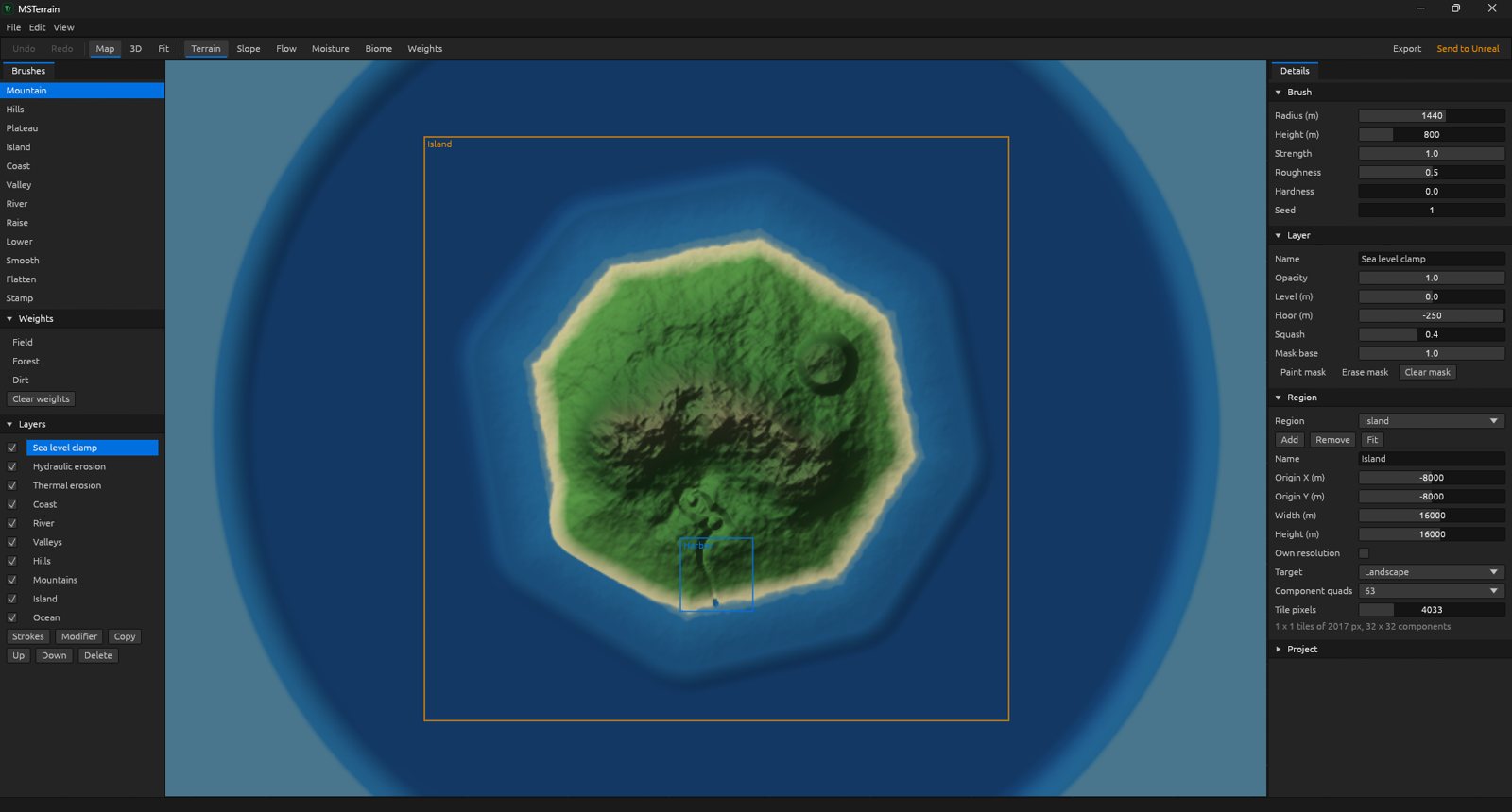
An island heightmap with the brush list on the left and layer and region settings on the right.
Everything in MSTerrain
Brushes
- Mountain, Hills, Plateau and Valley
- Island with a fractal coast and sea floor
- Coast brush for beaches
- River traced downhill, bed never rises
- Raise, Lower, Smooth and Flatten
- Stamp a height image
Layers
- Non-destructive strokes stored in metres
- Add, Max, Min and Replace blend modes
- Opacity, visibility and reordering
- Painted layer masks
- Duplicate layers
Modifiers
- Smooth and Terrace
- Thermal erosion
- Hydraulic erosion
- Slope limit
- Sea level clamp
- Road corridor with a width and grade limit
Views
- Map view and 3D view
- Paint in both views
- Paint Field, Forest and Dirt weights
- Undo and redo
- Templates: Island and Blank
Analysis
- Slope map
- Flow map
- Moisture map
- Biome map
- Field, Forest and Dirt weights from rules
Export
- Tiled Landscape with 16-bit heightmaps
- Landscape sizes Unreal accepts
- Mesh Terrain heightmap and RGB weights
- Per-region resolution and target
- Headless export from the command line
Start with the Island template and paint your coastline.
Monthly
$5 / month
All 22 apps
30-day free trial
Yearly Save 20%
$48 / year
All 22 apps
30-day free trial